China Launches New Satellite to Enhance Global Mapping and Belt and Road Logistics
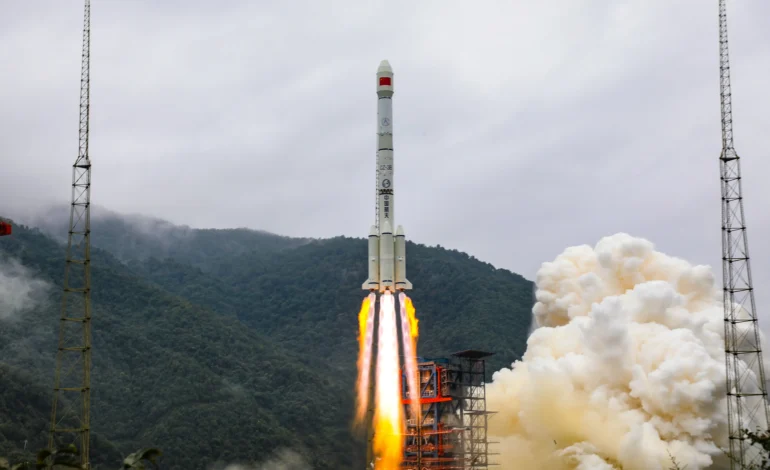
China successfully launched a new high-resolution satellite designed to strengthen global mapping, trade logistics, and environmental management under its Belt and Road Initiative (BRI). The satellite, named Gaofen-14 02, was launched from the Xichang Satellite Launch Center in Sichuan Province aboard a Long March-3B rocket on Sunday morning.
Officials said the launch marks a key step in upgrading China’s Earth observation network, expanding data coverage for infrastructure projects, transportation corridors, and climate monitoring efforts across Asia, Africa, and the Middle East.
Advanced Imaging for Global Mapping and Infrastructure
The Gaofen-14 02 satellite is equipped with next-generation optical imaging sensors capable of capturing three-dimensional terrain data with sub-meter precision. According to the China National Space Administration (CNSA), the satellite can produce detailed topographic maps and digital elevation models critical for smart city planning, rail construction, and resource management.
Data from the satellite will support major BRI infrastructure projects such as ports, highways, and logistics hubs. Officials said the technology will help optimize project designs and improve environmental risk assessment.
“The integration of high-resolution mapping with digital infrastructure management will accelerate the digital transformation of Belt and Road projects,” said Zhang Yulin, deputy head of CNSA’s space application department.
Nikkei Asia reported that the new satellite can transmit large data volumes through high-speed optical links, enhancing the accuracy of cross-border infrastructure mapping and trade logistics coordination.
Supporting the Belt and Road 3.0 Vision
The launch aligns with Beijing’s Belt and Road 3.0 strategy, which focuses on sustainable, tech-driven development. Under this framework, China is expanding the use of digital platforms, including AI and blockchain, to monitor construction progress and financial flows.
By linking satellite imaging with smart logistics systems, Chinese planners aim to ensure transparency and efficiency across project lifecycles.
CGTN said that the data from Gaofen-14 02 will be shared with BRI partner countries through a regional Earth observation network, helping them improve urban planning, agricultural mapping, and disaster resilience.
“Space-based data will play a fundamental role in bridging the digital divide among developing economies,” said Li Deren, an academician at Wuhan University’s State Key Laboratory of Surveying and Mapping.
Expanding China’s Role in the Global Space Economy
China’s growing satellite network now includes more than 300 Earth observation platforms, making it one of the world’s largest and most advanced geospatial systems.
The new Gaofen satellite will also contribute to global scientific initiatives, including climate change tracking and environmental sustainability assessments.
Industry analysts say the program underscores China’s ambition to position itself as a leader in commercial space services. Domestic companies are increasingly offering imaging and analytics solutions to international clients, particularly in logistics, agriculture, and mining.
“The combination of state-led technology and private sector innovation is turning China’s geospatial data network into a strategic global asset,” said Kenji Takahashi, a researcher at the Asia-Pacific Space Cooperation Center in Tokyo.
Strengthening Digital Belt and Road Infrastructure
Experts believe that the integration of satellite data into digital trade networks will redefine how China manages large-scale infrastructure projects.
With real-time mapping and AI-enabled logistics systems, BRI partners can coordinate construction timelines, track cargo, and monitor environmental compliance more efficiently.
The CNSA has confirmed that additional satellites under the Gaofen series will be launched in 2026 to enhance coverage across Europe and Africa.
As global competition in space-based digital infrastructure intensifies, China’s new satellite initiative illustrates how technology and diplomacy are converging to shape the next phase of global connectivity.