
China Expands Drone Operations at Scarborough Shoal as Maritime Tensions Persist
China’s coast guard has offered an unusual glimpse into how unmanned systems are being integrated into frontline maritime operations at Scarborough Shoal, a disputed reef in the South China Sea. Rather than emerging from a formal policy document, the details surfaced through official media coverage describing day to day drone activity around the contested waters.
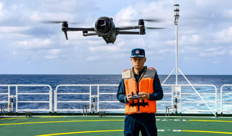
According to state media reports, coast guard personnel have been refining drone deployment techniques to document and monitor encounters with foreign vessels near the shoal. Officers described studying video footage during off duty hours to improve flight stability and image clarity in challenging open sea conditions. Operating drones from moving ships requires advanced handling skills, particularly when wind, waves, and vessel maneuvering introduce constant motion.
The accounts suggest that drone use is no longer experimental but increasingly standardized within the coast guard. Senior officers are reportedly training younger personnel in launch and recovery procedures, while structured instruction is being introduced to formalize operational competencies. The emphasis on vocational testing and systematic training points to long term institutional integration of unmanned aerial systems.
Scarborough Shoal, known in the Philippines as Panatag Shoal, remains a flashpoint between Beijing and Manila. Both countries maintain regular patrols in the surrounding waters. For China, geography presents logistical challenges, as the reef lies hundreds of kilometers from its nearest major bases. Sustaining manned aircraft patrols over such distances can be resource intensive.
Unmanned systems alter that dynamic. Long endurance drones can loiter for extended periods, providing surveillance coverage without placing pilots at risk. China has previously deployed platforms such as the GJ 2, capable of multi hour missions with surveillance payloads. Reports have also indicated the presence of other advanced unmanned aircraft operating in the broader South China Sea region.
The United States has supported Philippine maritime monitoring efforts with its own unmanned assets, including the MQ 9A Reaper. These systems provide maritime domain awareness and intelligence gathering capabilities. As a result, the airspace above disputed waters is increasingly characterized by persistent unmanned monitoring rather than sporadic manned overflights.
Beyond tactical surveillance, drones also serve an informational function. Recording encounters at sea allows governments to shape narratives by releasing footage that supports their territorial claims. In contested environments, documentation can carry diplomatic weight, influencing public perception and international discourse.
China has in recent years taken administrative steps reinforcing its claims in the area, while the Philippines has advanced its own legal and legislative measures. Against this backdrop, the growing use of drones reflects a broader shift toward gray zone competition, where states seek to assert presence without escalating to open confrontation.
As unmanned systems become more central to maritime security strategies, Scarborough Shoal illustrates how technology is reshaping disputed spaces. The South China Sea is no longer only a theater for naval deployments but also a domain where aerial persistence and real time surveillance play an increasingly decisive role.